
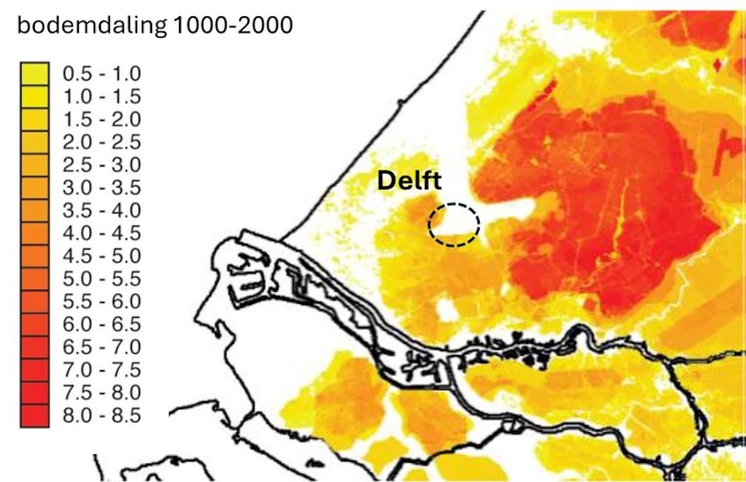
The western part of the Netherlands consists largely of clay and peat soils. This includes the area around Delft. These clay and peat soils are subsiding due to drainage and natural consolidation (compaction). Peat soils were also excavated. Furthermore, drained peat soils oxidize (a kind of slow burning). As a result, the soil has subsided by many meters over time. This map shows the estimated land subsidence around Delft over the past 1000 years (source: www.bodemdalingkaart.nl/nl/).
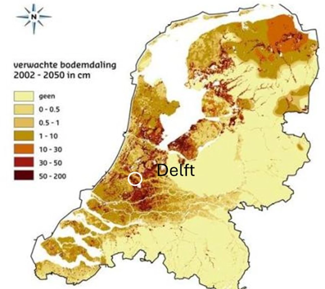
The soil in and around Delft will continue to subside in the future. Between 2001 and 2050, it is estimated that the subsidence will range from a few centimeters to several decimeters (Atlas of the Living Environment).
Years of groundwater extraction by DSM have also caused land subsidence, see the New Delft Water Walk, groundwater extraction by DSM. Fortunately, this extraction has now almost completely stopped and no longer induces land subsidence in and around Delft.
Initially, Delft was built on the creek ridge of the Gantel. But after only a few centuries, Delft had to expand with buildings on less solid soils, such as clay and peat. This is clearly visible on this map showing city rights granted over the years.
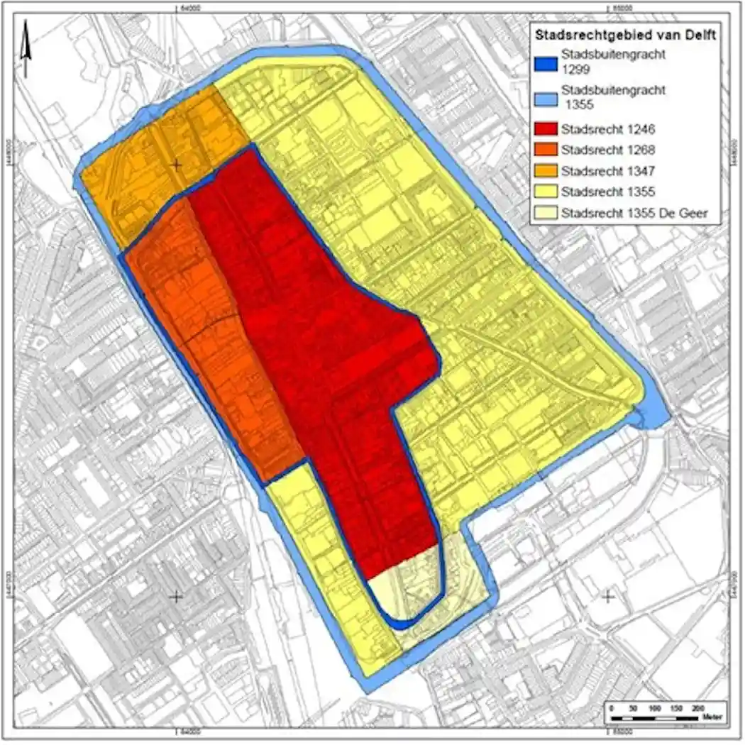
Due to peat extraction, construction, and drainage, the new eastern part of Delft has subsided much more than the original buildings on the creek ridge. This is clearly visible along Geerweg, Rietveld, and Vlamingstraat. Consequently, this part of the city increasingly suffered from flooding during heavy rainstorms. To minimize this nuisance, the concept of the “Closable City Center” (Afsluitbare Binnenstad) was introduced; see Oude Delftse Waterloop (Old Delft Watercourse) stops 5 and 8.