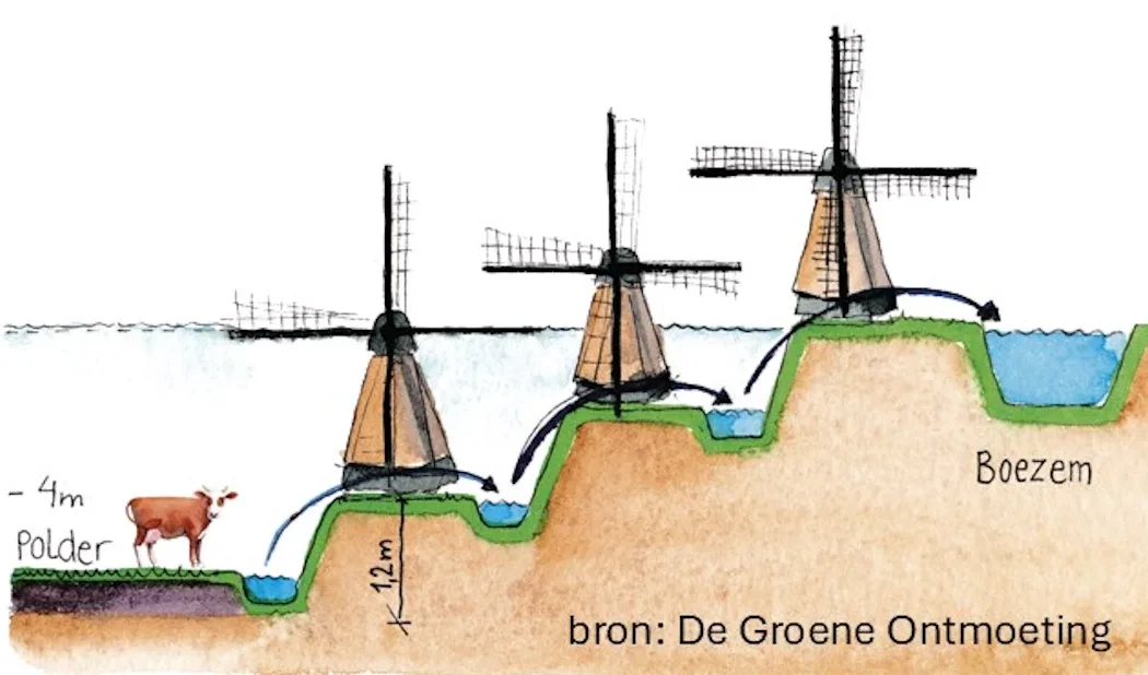
A polder is a closed, low-lying area of land surrounded by flood protection (dikes, levees). The water level in such a polder must therefore be artificially regulated. This is done via locks, spillways, and pumps.
Polders were constructed in The Netherlands already in the 11th and 12th century.
The word polder comes from the old Dutch word “polra,” meaning “elevation of alluvial land”. It has been literally adopted in 36 languages across the world.
There are various types of polders, see Wikipedia. Around Delft, you only find peat polders, actually lowland peat polders. Such polders are created by pet mining, causing the area to subside (subsidence). Drainage is then necessary. This is achieved by digging ditches and canals. A wetering is a somewhat wider drainage ditch. Weteringen are, in turn, connected to a Boezem (Bosom, primary drainage canal) or Binnenboezem (Inner Bosom, secondary drainage canal). This creates a hierarchy of canals and ditches, with locks, overflows, and pumps.
These canals and ditches may not silt up or get overgrown with vegetation, as this would block their drainage function. Landowners are therefore obligated to keep their waterways clean and their banks stable. This is checked twice a year by water board inspectors during a so-called “schouw” (inspection). These inspectors are volunteers, and work directly under the supervision of the Dijkgraaf (the Water Board director).
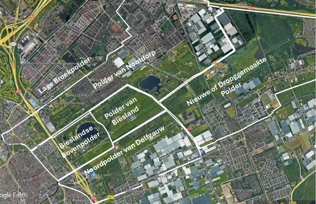
The Buiten Delftse Waterloop takes us along three polders: the Biesland Bovenpolder, the Biesland Polder, and the Polder of Nootdorp. These polders are shown in the Google Earth satellite image below. The water management in these polders is explained here.