Outer Delft Water Walk
Other sights
There are many other interesting places in the polders northeast of Delft. However, they are a bit further away and must be visited by bike. This can be combined easily with the walk described above, as you can also complete it entirely by bike.
Download Route Buiten Delftse Waterloop by bike (PDF)
We cycle along the Hazepad, following the Tweemolentjesvaart canal, towards Dobbeplas, all the way to Nootdorp.
We cycle northeast along Hazepad to Nootdorp. On the right, you see the Dobbelplas lake and on the left, the Nootdorp Ice Skating Club. After crossing the village boundary (sign for Nootdorp), we immediately turn left onto the Oudeweg. Then almost immediately turn right, opposite to windmill “de Vang”. We follow the Geerweg for 550 meters to the crossing with the Laakweg.
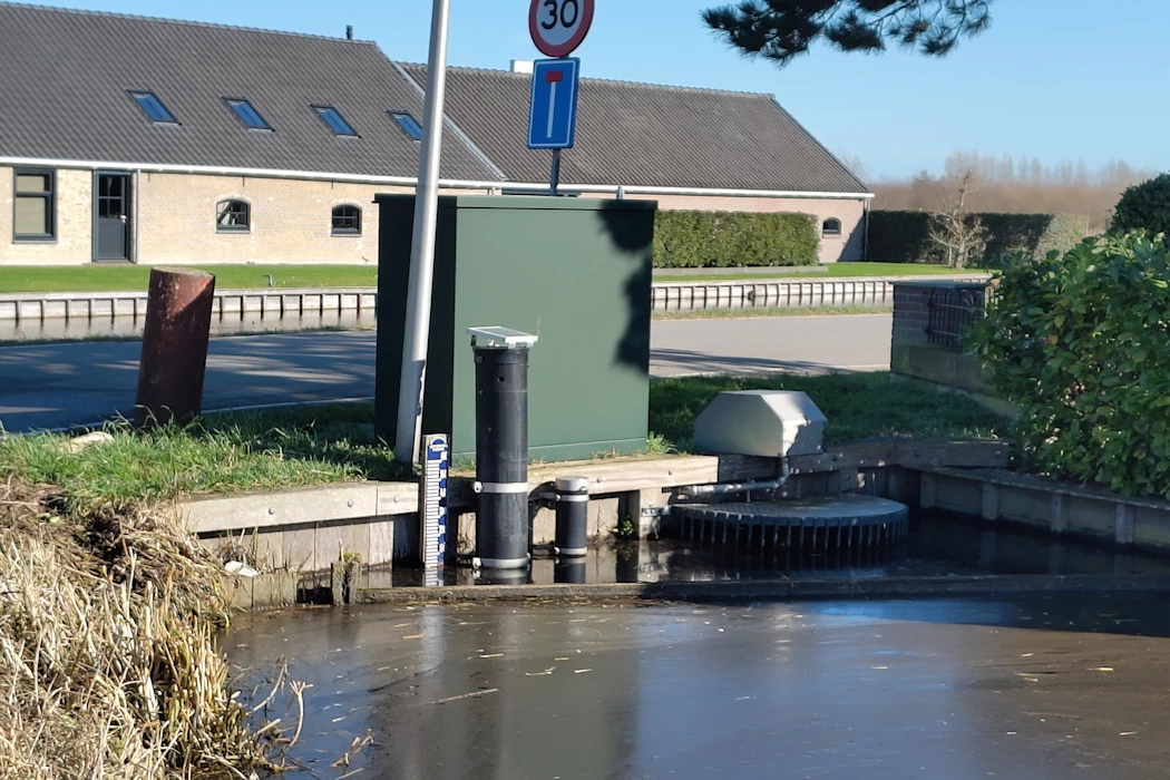
The Geerweg runs along a branch of the Binnenboezem canal that begins at the Tweemolentjesvaart canal. This branch ends at the Geerweg-Laakweg intersection. A remotely controlled weir regulates the flow of water from the Binnenboezem into the surrounding polders.
Around this intersection, you can see five (!) different polder water levels, maintained by numerous overflows and weirs. And a little further back, the gardens of the houses (nos. 61 and 63) are very low-lying. Here you can see the cascade of water levels and how this regulates circulating the water in the polder ditches:
- -2.63 m NAP to -3.12 m NAP in the north;
- -3.12 m NAP to -3.50 m NAP in the northwest;
- -2.30 m NAP to -2.35 m NAP in the south;
- -4.90 m NAP to -5.0 m NAP in the southwest;
- -3.12 m NAP to 3.50 m NAP in the west.
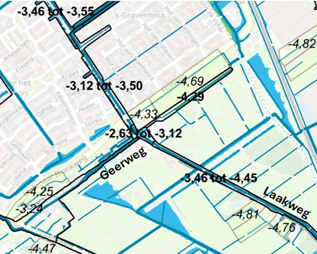
Eleven different polder levels within short distance.
All these water levels are also shown on the map above, taken from the map of the Delfland Water Board (the so-called “Lleggerkaart“).